
Hydrographic Surveying & Cadastral Mapping Solutions
Welcome to Worldwide Survey Dynamics
Precision. Innovation. Impact.
Strategically rooted in excellence and driven by a commitment to global standards, Worldwide Survey Dynamics delivers end-to-end Hydrographic Surveying and Cadastral Mapping solutions across marine, offshore, and terrestrial environments. From the seafloor to the skyline, we empower infrastructure, industry, and innovation.
With a reputation built on accuracy, integrity, and adaptability, we combine cutting-edge technology, IHO/IMCA-compliant methodologies, and specialized training to meet the evolving demands of hydrospatial projects worldwide. Whether you’re mapping coastal zones, supporting offshore wind development, or delineating legal boundaries, our certified professionals are ready to support your mission.
Our Expertise Includes:
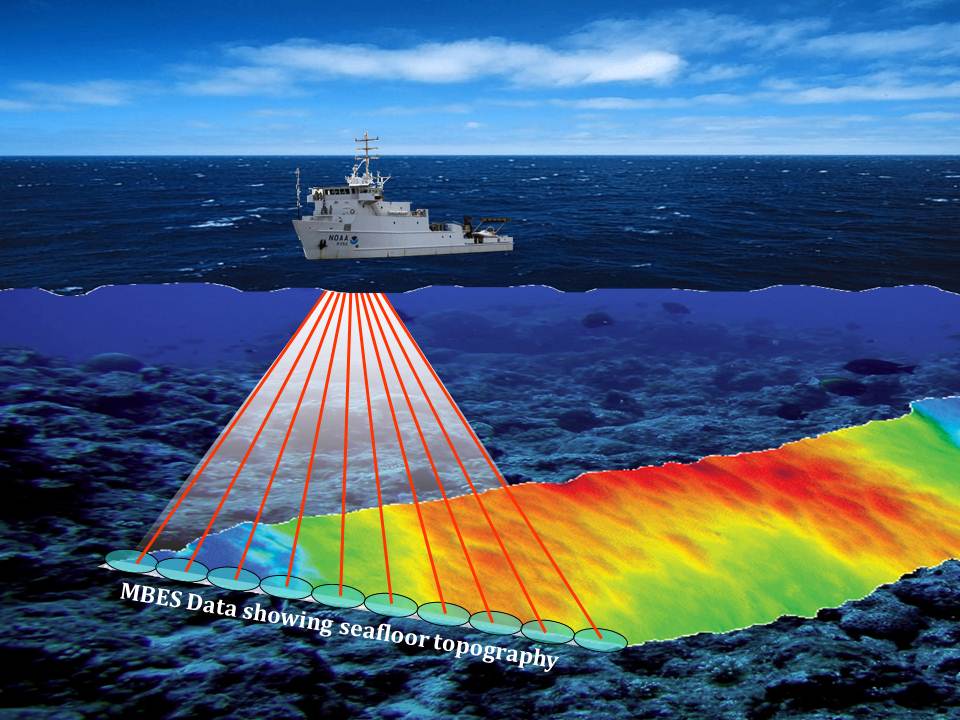
- Multibeam Bathymetry (MBES)
Side-Scan Sonar Imaging
Magnetometer Surveys
ADCP Current Profiling
Sub-bottom Profiling
Cadastral and Geospatial Mapping
Geodetic Control and GNSS Integration
Custom Training for Survey Teams
Our Mission & Vision
At Worldwide Survey Dynamics, our mission is to deliver actionable geospatial intelligence and nurture the next generation of hydrographic professionals through capacity-building, collaborative consulting, and technology-driven solutions. We envision a world where accurate mapping fuels safer navigation, sustainable development, and smarter decision-making across borders.
No coastline is too remote. No boundary is too complex. Let us help you navigate with confidence.
How Can We Support Your Project?
🚢 Request a Hydrographic Survey
📍 Hire a Certified Surveyor or Consultant
🎓 Enroll Your Team in Specialized Training
Worldwide Survey Dynamics – Charting Excellence, Globally.